
|
|||||||
|
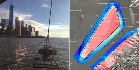
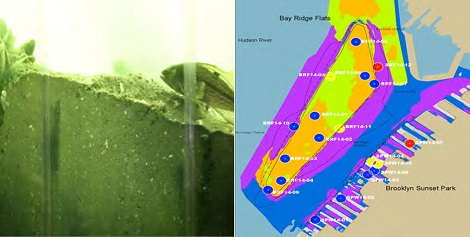
Biosurveillance in New York HarborThe New York State Department of Environmental Conservation partnered with the New York City Department of Environmental Protection to map the shallow waters in the Hudson and East Rivers. e4sciences mapped the sediment strata, the shoreline structures, and the benthic infaunal communities along the western shoreline of Manhattan and the northwestern shore of Brooklyn. e4sciences measured the bathymetry, sonar and seismic reflectivity, sediment chemistry, grain size, and benthic organisms. Analyses of the benthic communities show a strong association with sediment type, specifically grain size. The more diverse and well-established communities live in the sandier environments. There are healthy communities in the siltier, fine-grained sediments, but these communities are sensitive to sediment accumulation rates. e4sciences identified the following controlling factors for the spatial distribution of the benthic communities: geological or structural substrate, well-circulating cleaner water, and anthropogenic disturbance. Over the past 40 years, better water quality and decreases in the amounts of pathogens, pollutants, and suspended sediments have contributed to the improved health of benthic communities. |
||||||