
|
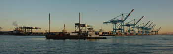
Harbors & docks
- Navigation — Map obstructions with sonar, seismic & electromagnetic surveys
- Sedimentation — Map suspended & deposited sediments with sonar & seismic surveys, quantify the dynamics
- Dredging — Map materials, debris & obstructions with sonar, seismic & electromagnetic surveys
- Material separation — Map the thickness & extent of offshore-unsuitable sediments
- Storm surge — Monitor & predict surge for safety of facilities & people
- Rock for foundations — Map top of rock & rock properties
- Sea-level rise — Measure & predict susceptibility of shoreline facilities to long-term rise; scenarios modelling
- Preconstruction surveys — Determine site conditions & hazards to safety
- Dock condition surveys — 3D surveys of submerged & exposed docks
|
