
|
|||||||
 Loading the player...
|
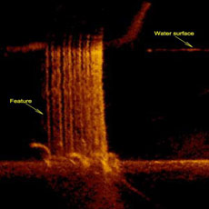
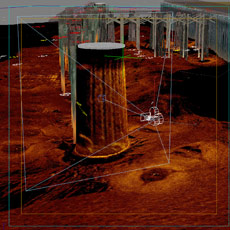
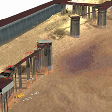
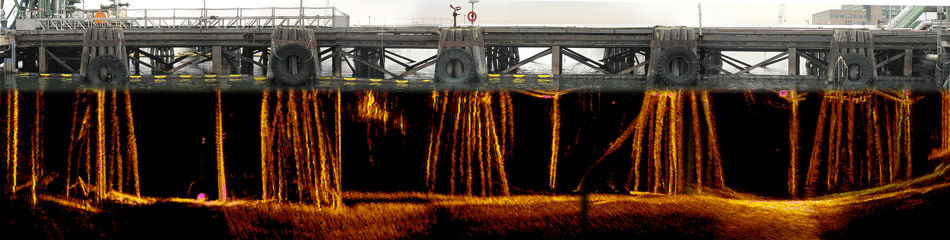
Refinery Docks
e4sciences|Earthworks mapped the pilings, beams, dolphins, bathymetry, debris, sediments, and top of rock of docks of a refinery. We used sector scanning in combination with multibeam bathymetry, side-scan sonar imaging and sub-bottom imaging to map every underwater member of the two docks. Digital photographs of the dock above the water surface were correlated with the underwater features mapped by sonar. The state of the dock and dolphins were characterized with regard to their structural integrity. e4sciences|Earthworks transferred to the owner three-dimensional representations of the docks in AutoCAD format in order to provide base maps for inspectors and rehabilitation engineering.
| ||||||
|
|||||||