
|
|||||||
|
Mapping of Berry’s Creek
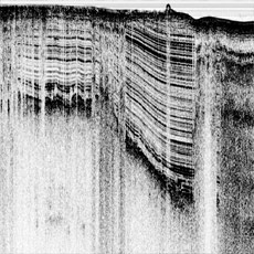
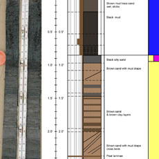
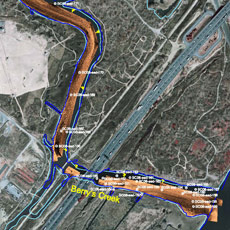
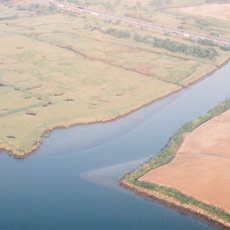
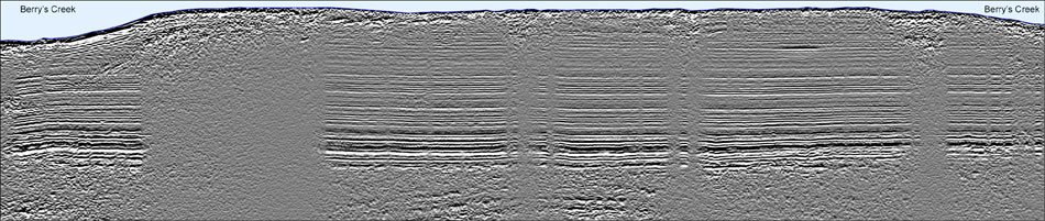
An environmental liability company assigned e4sciences|Earthworks to produce base maps for 7 miles of Berry’s Creek and Berry’s Creek Canal, once considered one of the most polluted waterways in the United States. We measured the water depth, morphology, infrastructure, thickness of industrial sediments, debris, and rock basement in the creek and canal. The measurements included seismic imaging, sonar orthosonographs, multibeam bathymetry, magnetic field, and sediment cores. The thickness of industrial sediments, the source of concern, varied throughout and was always less than 10ft.
|
||||||
|
|||||||