
|
|||||||
|
Loading the player...
|
Newark Bay
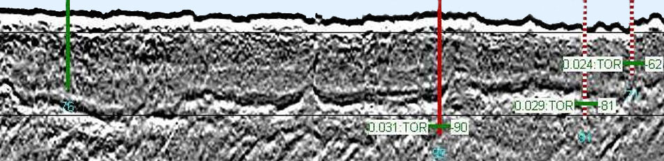
The New York District of the USACE ordered e4sciences|Earthworks to map the black silt using sonar imaging; to map the top of rock using seismic imaging and core borings; to collect, analyze, and model the time-sequence bathymetry from 1850 to 2012 in the Newark Bay Study Area; to segment the bathymetry into morphological features; to determine the time sequence of natural and engineering events in the NBSA; to determine the sedimentation rates; and to determine the location and extent of industrial-age deposition from 1934 to 2006. The geomorphological and sedimentation investigation helped the District of New York to reach a settlement with the Southern District Court regarding the accurate evaluation of recent industrial-age deposits within the Newark Bay Study Area. An animation of the bathymetry was produced to ease the understanding of the recent evolution of the bay. Sonar imaging and coring became an acceptance criteria for black silt removal during dredging.
|
||||||
|
|||||||