
|
|||||||
Loading the player...
|
Enhancement of the Hackensack River
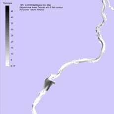
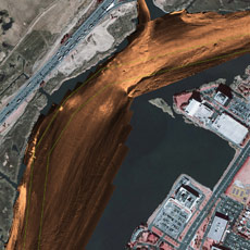
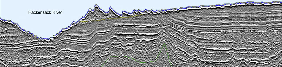
The New York District of the USACE ordered e4sciences|Earthworks to map the channel and flats of the lower Hackensack River from shore to shore for the 14 miles from Overpeck Creek in Ridgefield Park to Kearny Point, New Jersey. Sonar imaging produced twin orthosonographs with better than 1ft resolution. From the orthosonographs and cores, e4sciences|Earthworks classified the morphology and sediments throughout the entire length. Seismic reflection imaging mapped cross sections of the stratigraphy from top of rock to mudline. One hundred and thirty surface cores were used to correlate with the sonar imaging and seismic reflection images. Multibeam sonar measured the bathymetry from shore to shore throughout the entire length. Magnetic field measurements identified pipelines, cable crossings, debris, and obstructions. Analyses of historical bathymetry from 1840 to 2006 determined the location and thicknesses of modern industrial-age sediments. Integrated interpretation of seismic imaging, sonar imaging, cores, and historical data identified the depositional centers of black silt in meander bars and in Harmon Cove. Three hundred sediment profile images recorded the sediments and benthic organisms in 100 locations. Physical measurements were correlated with benthic-community assay and formed the basis for classification of the benthic community.
|
||||||
|
|||||||