

|
Arthur Kill oil pipeline crossings
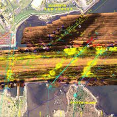
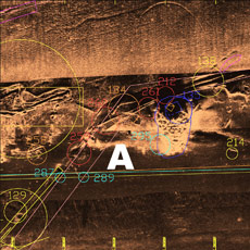
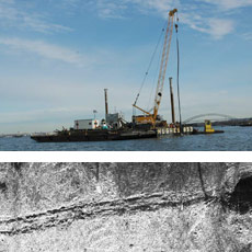
The USACE ordered e4sciences|Earthworks to identify and map the location of pipe crossings in Arthur Kill, to transfer those results to Ocean-Coastal Consultants (OCC) for design documents, and to produce acceptance surveys to ensure that all pipes and pipe debris was removed before dredging could commence. We discovered over twenty pipe crossings in the area, many without permits and many reported previously removed. The acceptance surveys used magnetic field measurements and sonar imaging to detect pipes or pipe debris. Remaining pipes or pipe debris was removed and the surveys repeated until clear. The ultimate consequence of the project was that the dredge contractor reported NO pipes or pipe debris upon dredging the area. During the pipe removal, the US Coast Guard reported a navigation hazard from a pipe standing upright in the channel. Caldwell Marine, the contractor for pipe removal, employed e4sciences|Earthworks (with the permission of the USACE) to check continually with sonar imaging for navigation hazards and exact pipe locations during construction.
|