
|
|||||||

|
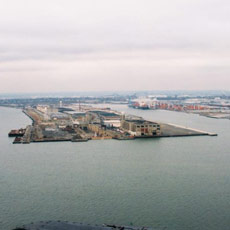
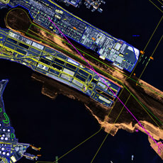
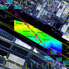
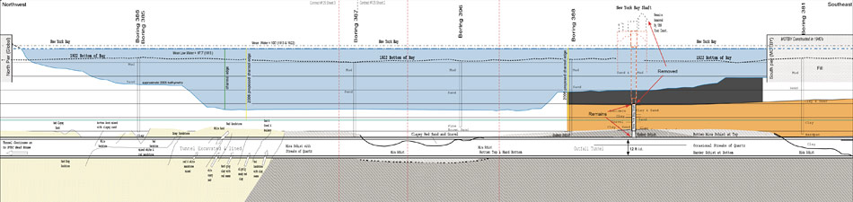
Passaic Valley Sewerage Commission (PVSC) Tunnel
The New York District of the USACE ordered e4sciences|Earthworks to locate the PVSC tunnel in Port Jersey Channel accurately in northing and easting, to drill eight core borings as close to the PVSC tunnel as possible, to locate the New York Bay Shaft of the PVSC tunnel, and to determine the elevation of the top of the PVSC tunnel. To accomplish these tasks, e4sciences|Earthworks completed a survey of the entire reach from Jersey City to the diffuser on Robbins Reef in New York Harbor. This survey included marine geophysical measurements as well as analyses of historical data from the PVSC. Independent confirmation by Hager-Richter at Global Marine set the accuracy of our results at ±0.5ft. Core borings confirmed that in Port Jersey Channel, the PVSC tunnel sits in highly weathered sandstone and schist. e4sciences|Earthworks determined the top of the New York Bay shaft by drilling two wells within 15ft of the shaft. The boreholes were logged with magnetometers and sonic tools and the elevation of the top was measured to ±1 foot.
|
||||||
|
|||||||